Al Hawqayn is one of the most popular wadi spots in the Al Batinah area of Oman. With year-round water and just over an hour’s drive from Muscat, crowds flock here to enjoy the pools and waterfalls. It is possible to reach here with 2WD but if you are lucky enough to have a 4×4 the southern approach along Wadi Bani Hini is a lot more interesting!
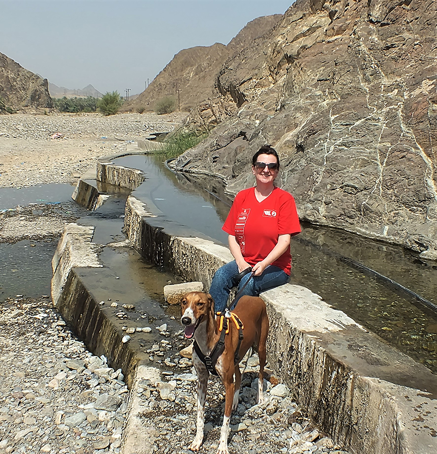
Falaj built at the base of the rocks
As far as offroad driving goes, this is an easy route; in fact, anyone with a 4×4 and a modicum of common sense should be able to tackle it successfully.
The wadi route snakes its way round the mountains for around 28kms and unless you visit immediately after rain, it is unlikely there will be big rocks in the way. Most probably, there will be one or two well beaten tracks which you should follow. We took around 3.5 hours to complete the route, including stops.
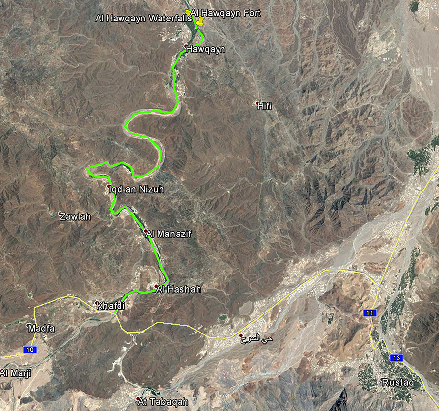
Al Hawqayn route
The start would make a great hike too – walk up the wadi early in the morning until you reach the beige bridge at 7kms, returning to your car in the shade of the palm trees as the day grows hotter.
Firstly, however, check the weather forecast before the trip – if rain is likely in the area, give the wadi trip a miss. A flash flood can occur whenever rain falls “upriver” and it will be almost impossible to exit in places if faced with a rapidly advancing wall of water.
A quick check on google earth shows 11 villages alongside the wadi; the first five can also be reached via blacktop road to the west, the next five are accessible by a track along the wadi floor and the final one is our destination point from where you can drive out in 2WD.
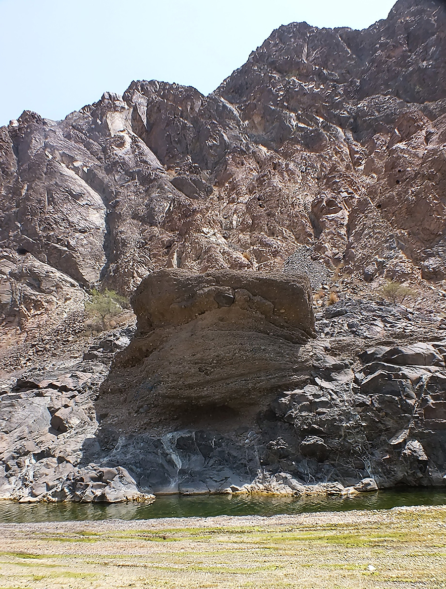
Stunning rock formations
Drive to Rustaq (the new Muscat Expressway now stretches as far as the Rustaq Road), then take the road to Ibri and after around 15kms take a right just before the bridge at 23.42211 57.29910. The blacktop road becomes a track after 50 metres, dropping down to the wadi floor where you should turn right.
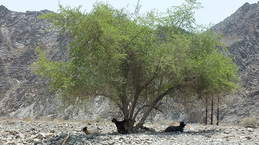
It’s not an Oman trip unless you have seen goats
There is a falaj system built into the foot of the rocks at 57.43200 57.31675, worth a stop if you have thirsty hounds in the car, and from where you will be able to spot the star attraction of this route – a huge fort, seemingly “marooned” in the middle of the wadi. I cannot find a name for it, hubby suggests “SS Fortitude”, though our guess is it will be known as “Al Hashah Fort” (23.43237 57.31976). When you are out of your car to photograph it, as we are sure you will be, cast your eyes upward and to the west to see a ruined watchtower overlooking the lush oases which line the first half of the wadi.
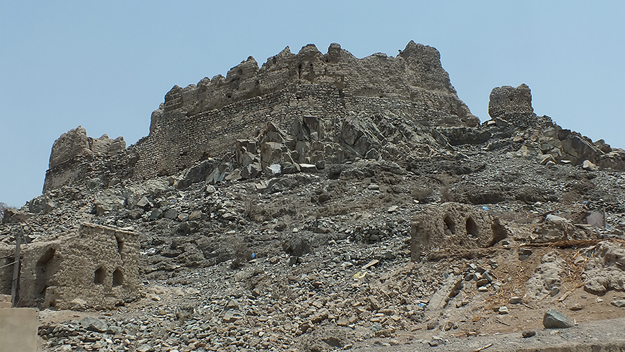
Al Hawqayn Fort back
For every plantation, there seems to be an inhabited village and if you feel the need to get out of your car and stretch your legs for a bit, they are well worth a look. Do park in the wadi and walk in, as most of the streets were not designed for 4×4 vehicles making it a tight squeeze in a few places if you do try! You will see far more if you walk; ancient falaj systems delivering water to a variety of produce such as dates, corn and bananas; old houses with intricately decorated doors; workers tending or harvesting the crops; some villages even have tiny coffee shops! I recommend you wear conservative clothing covering from at least the neck to the knee to show respect for the local inhabitants. You are quite likely to be invited in for ghawa (Arabic coffee) and dates and I urge you to accept any such invitation if you have the time as this is a great way to learn more about Omani Culture. If you must decline, then say “maratania, inshallah” which translates to “next time, inshallah” which is a much gentler and more culturally correct alternative to saying “no.”
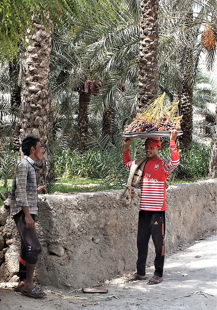
Dates harvest
Returning to your car, continue following the wadi for another 22kms or so; if you need an early get-out then you can exit at 23.46780 57.30650. The scenery is stunning with red and brown mountains stretching skywards from the wadi floor, an old abandoned village at 23.46591 57.29845 and many water pools, some with little black fish in them!

Lots of shallow water in the wadi
Once you reach the settlement of Al Hawqayn, follow the route to the left of the wadi which is signposted Howqayn and which will eventually see you at the back of the old ruined fort (23.54754 57.33474). Continue onwards and downwards until you reach a track crossing of the wadi (23.55670 57.33682). Here you have the choice of continuing up the hill, turning right at the top if you wish to go to the Hawqayn Waterfalls. Incidentally the best view of the old fort is from this road (23.54938 57.34012). Alternatively, turn right in the wadi bed and offroad until you reach the pools, somewhat away from the crowds, at least on a Saturday in August!
Over the past few years Oman has invested heavily in an extensive road building program and one such project is a blacktop in from Al Hawqayn to the villages of Al Madinah and As Sib, half way down the wadi. When completed, this will make life so much easier for the village inhabitants but may also bring crowds of picnickers to the many pools along the route. If you can, go now, while it is still beautifully remote and relatively undiscovered! ■
Words by: Marina Bruce
Photos by: Neil Bruce and Rosemarie Hayne
Marina Bruce is The Desert Diva. You can read about her travels on www.thedesertdiva.com, connect with her on Instagram (thedesertdivame), twitter (@15shadesofsand) or Facebook page (https://www.facebook.com/DesertDivaUAE/)